Cristobal forms with devestating flooding to continue; threat to US mainland early next week6/2/2020 Tropical storm Cristobal, located in the Bay of Campeche will slowly meandar for the next 48 hours near the coast, and may reach the coast. This will cause drenching rain for Central America and southern Mexico on top of the deadly flooding that will already occur. After that time, the system will move to the north into the western Gulf of Mexico, and move to the Gulf Coast. Some details have still yet to be worked out for where the landfall will occur exactly. However, this system is a relatively large storm embedded inside of a Central American Gyre. High surf is guaranteed for most of the Gulf Coast. However, heavy rain is likely for a large portion of the Gulf coast. Models are suggesting that the storm will be a heavy east storm. The threat for wind and storm surge is yet to have an exact placement, and even intensity. The most likely area based on model guidance at this time appears to be somewhere on the Louisiana coast. It is likely that where it makes landfall will have the strongest winds, and east of the center will experience some storm surge. The intensity forecast currently has Cristobal packing winds of 60 MPH. However, depending on if it moves inland over Central America, the intensity could change. The best thing to do is not panic, and review hurricane safety plans, and keep a close eye on the forecast as details are ironed out. Top Image: Satellite. Image courtesy Tropicaltidbits. Bottom Image: NHC key messages and graphics. 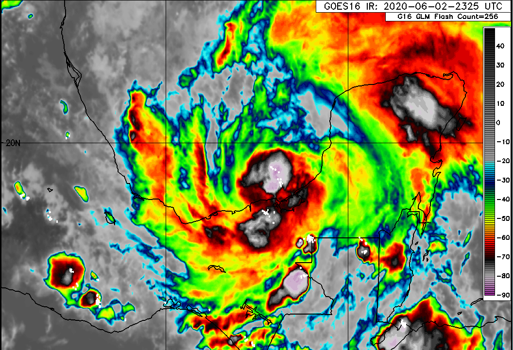 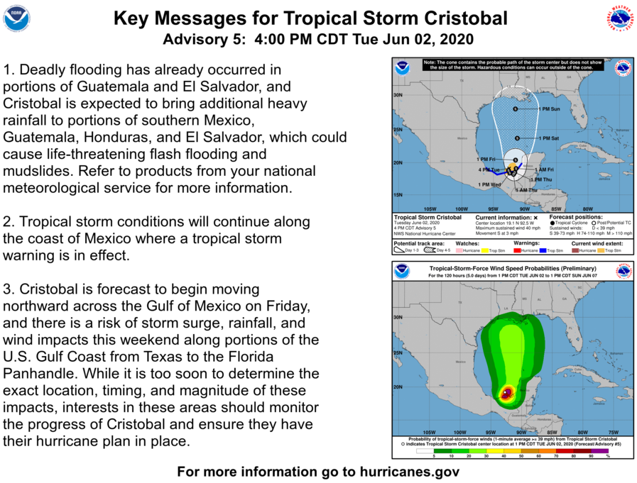
2 Comments
Mr. H
6/3/2020 06:03:05 am
What are the chances for further development and intensification? Does the location of the jet stream affect this at all?
Wyatt
6/3/2020 10:28:27 am
Currently, the possibility is starting to diminish a little bit for major intensification. It could still be a strong tropical storm by landfall, as noted by the NHC. And yes, the ject stream could affect the strengthening of the system. If the jet stream is really close, then the storm will weaken. I think a 65 MPH landfall is most likely at this time! Stay tuned for updates, and remember to stay prepared! Leave a Reply. |
 RSS Feed
