|
Cristobal's wind field is getting very close to shore, and Tropical Storm conditions will likely commence along the Louisiana coast, getting to the rest of the Tropical Storm Warning, from central Louisiana to Florida by tomorrow morning. Gusty winds of over 40 MPH have been reported less than 50 MPH offshore from the mouth of the Mississippi river area of Louisiana, and Grand Isle, Louisiana. The maximum sustained winds as of 7 PM CDT was 50 MPH, and the strongest winds at landfall will likely be up to 60 MPH. These effects will extend well away from the center, up to 400 Miles away. This graphic is the most likely arrival time of winds for your location. 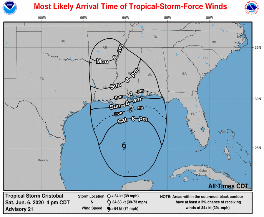 Wind Field and Tropical Storm Warnings.  Another threat from Cristobal is the rain threat. Flash flooding is likely very far away from the center, possibly into south Florida. The highest rainfall totals are 6 to 10 inches in Louisiana and Mississippi, and in the Big Bend of Florida. Elsewhere, totals of 2-6 inches are expected. This could cause some scattered flash flooding for these areas. Any preperations should be rushed to completion now, and stay calm. This is the last blog post for Cristobal, unless there is extreme changes. Graphic below: rainfall totals. 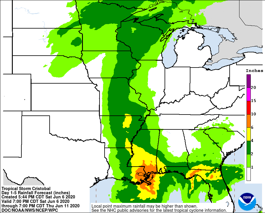
0 Comments
The NHC has issued Tropical Storm and Storm Surge watches for the Gulf coast and Yucatan Peninsula ahead of Tropical Storm Cristobal. The storm is nearing water and the structure is looking better. The system will move north, and some dry air may be wrapped around. However, the center appears to be near convection, and the storm looks tropical instead of subtropical like some models were saying for Cristobal at this time. The threats for Cristobal is mainly rainfall and storm surge. Rainfall totals of 6 to 10 inches are possible for the Louisiana coast, and up to 6 inches sor a large area of the central gulf coast.  Another threat is the storm surge, with total storm surge values of 2-4 feet in Louisiana and in the Florida Big Bend where the storm surge watches are. The wind threat is somewhat lower in confidence, but Tropical storm force winds sustained are likely along the coast for the entire tropical storm watch area, inland into Louisiana and western Mississippi. Tropical storm gusts are possible around the area where sustained winds are expected. The peak winds are expected to be around 60 MPH with gusts to 70 MPH at landfall. However, since it did strengthen over land, and the dry air and sheer appears to not be effecting it this much at this time, a Hurricane at the gulf coast is not completly out of the question. There is only 48 hours left until conditions become dangerous, so areas under any threats should review their tropical preparedness plans, and follow instructions by officials. Stay tuned for updates. 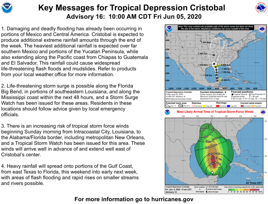 Cristobal forms with devestating flooding to continue; threat to US mainland early next week6/2/2020 Tropical storm Cristobal, located in the Bay of Campeche will slowly meandar for the next 48 hours near the coast, and may reach the coast. This will cause drenching rain for Central America and southern Mexico on top of the deadly flooding that will already occur. After that time, the system will move to the north into the western Gulf of Mexico, and move to the Gulf Coast. Some details have still yet to be worked out for where the landfall will occur exactly. However, this system is a relatively large storm embedded inside of a Central American Gyre. High surf is guaranteed for most of the Gulf Coast. However, heavy rain is likely for a large portion of the Gulf coast. Models are suggesting that the storm will be a heavy east storm. The threat for wind and storm surge is yet to have an exact placement, and even intensity. The most likely area based on model guidance at this time appears to be somewhere on the Louisiana coast. It is likely that where it makes landfall will have the strongest winds, and east of the center will experience some storm surge. The intensity forecast currently has Cristobal packing winds of 60 MPH. However, depending on if it moves inland over Central America, the intensity could change. The best thing to do is not panic, and review hurricane safety plans, and keep a close eye on the forecast as details are ironed out. Top Image: Satellite. Image courtesy Tropicaltidbits. Bottom Image: NHC key messages and graphics. 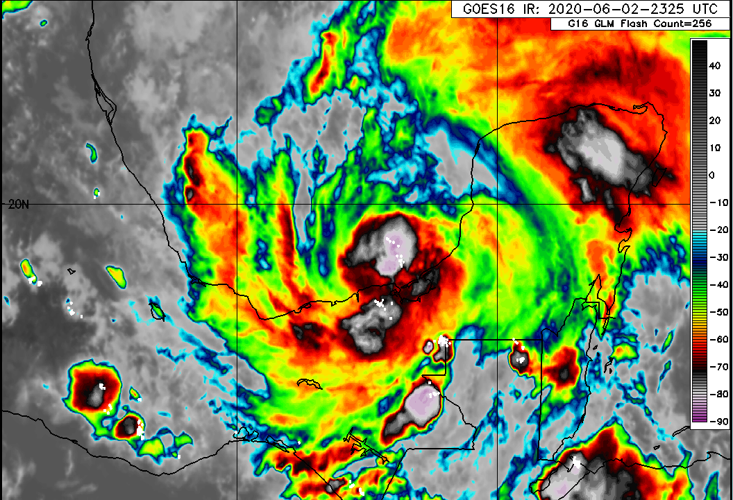 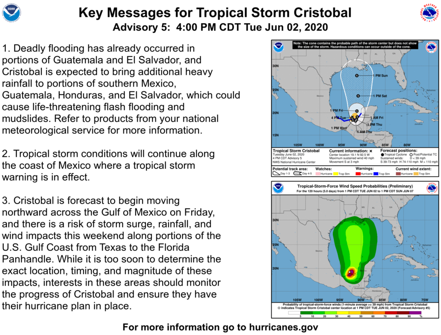 Invest 93-L, located just off the coast of the Yucatan Peninsula, which is the remnants of Amanda, will continue moving over the Bay of Campeche. It will stall there for some time. The exact amount of time is currently unknown, but could be until Saturday According to some models. After that time, the storm will either go inland over Mexico, or could impact the US. This is a very uncertain future. If it were to impact the US, the area of landfall is still a question yet to be answered. Anywhere between Houston, Texas and Mobile, Alabama could see a landfall. The threats from the storm would mostly be rain and rough surf. Some gusty winds could occur around the storm in some of the bands. The timing is unknown, and according to the models, it could begin impacting as early as Friday or as late as the middle of next week. It is early in the season after all and I would not worry to much about this storm. Just watch out and remember to prepare, especially since it is in the beginning of the Atlantic Hurricane Season. Top image: Satellite imagery with the "X" marking the center Bottom image: Spaghetti models for 93-L 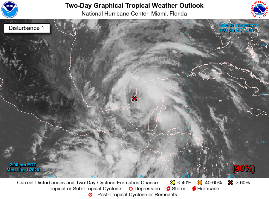 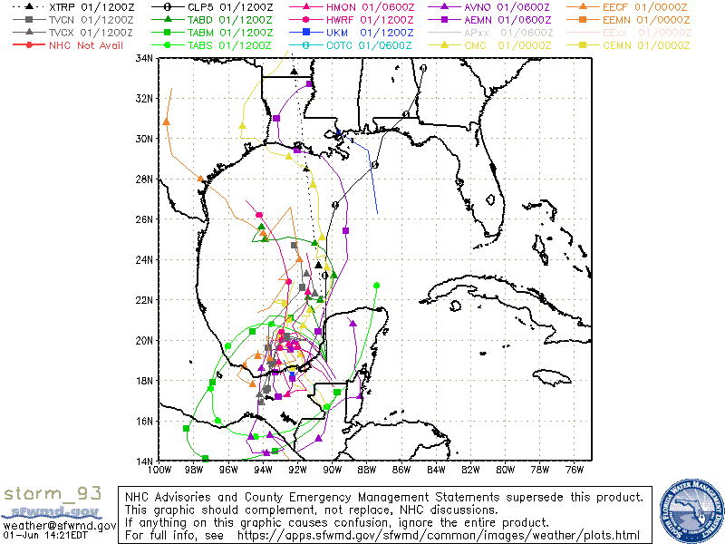 |
 RSS Feed
