|
At 8 AM EDT this morning, the National hurricane center upgraded a disturbance to Tropical Storm Bertha with winds of 45 MPH. This will move onshore in a few hours, and will weaken to tropical depression status. The main threat is the flooding threat, with flood advisories in effect. Rain totals of up to 4 inches are expected along the South carolina coast. Otherwise, this storm will be just a nuisance, with nothing really to worry about. This is a rare start to a season, with two preseason tropical cyclones. 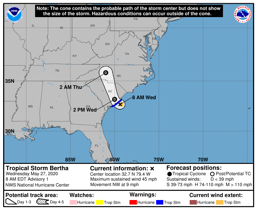 
0 Comments
The National Hurricane Center is Monitoring an area of low pressure that could become a (sub)tropical cyclone in the next two days. The low is moving northeastward. This could move into the Bahamas, bringing heavy rain, and tropical storm force winds to 40 MPH possible in the Bahamas. On southeast Florida's coast, some heavy squalls are possible for the area. A few gusts to tropical storm force are possible, but the main threat will be heavy rain to 2 inches, and rip currents. Stay tuned to the National Hurricane Center for more information as this system develops. Top Image: Current satellite with the X marking the center. Bottom Image: Possible tracks, image courtesy Tropical Tidbits. 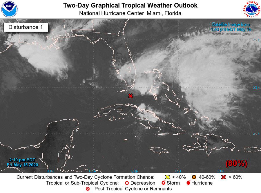 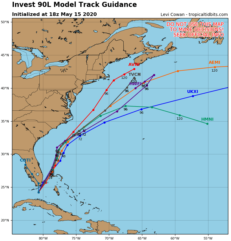 |
 RSS Feed
